Browse Items (1400 total)
Sort by:
Walter Whitman
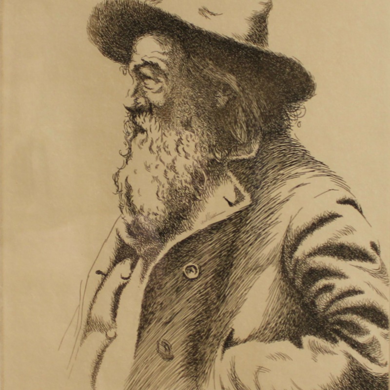
A tightly framed portrait shows the elderly American poet in profile, informally dressed. McMillan's etching creates texture and expressive lines on Whitman’s face, applying fine strokes to achieve realism. Whitman’s hair and beard are at the center…
Children
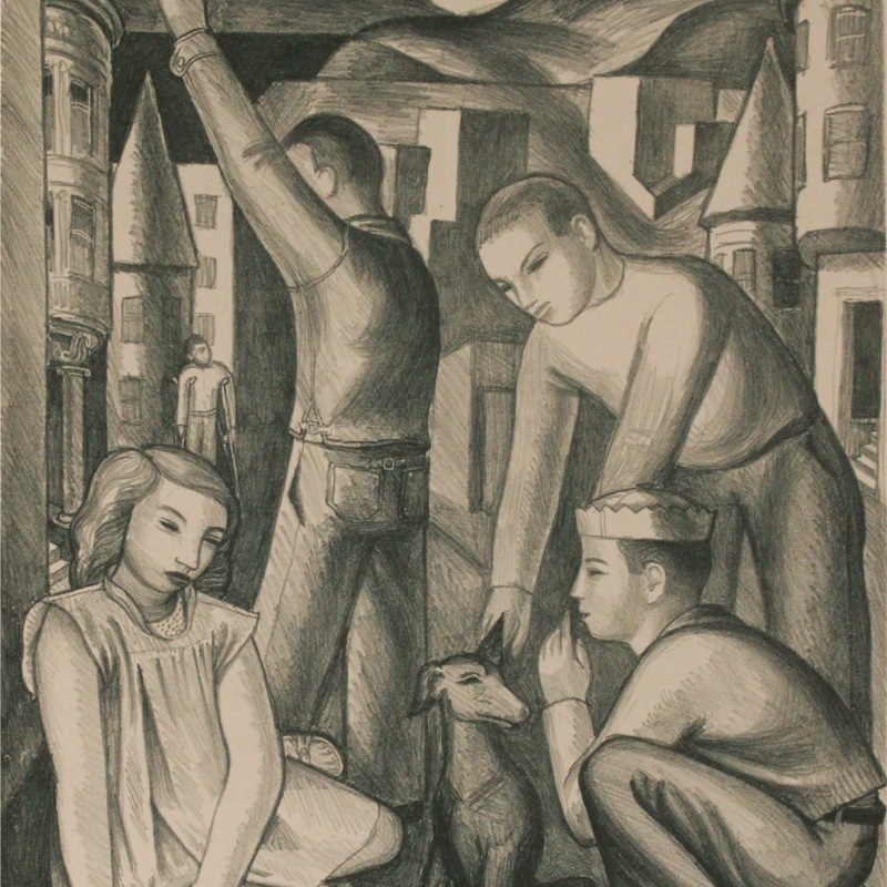
In the foreground are four children and a dog, each making a somewhat inscrutable gesture. Behind them, in the middle ground, another child walks toward them using a pair of crutches—again, leaving us to speculate as what has happened and the…
"Spanish Life" Mural
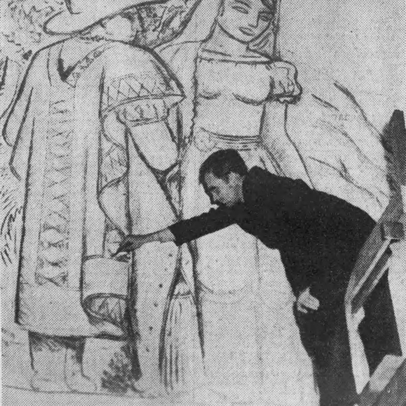
A caption to this photo reads: "John Moxom, WPA Federal Art Project artist, is shown at work on the charcoal sketch for his mural, 'Spanish Life,' which will be placed in the Hillsborough Distriet School." According to Moxom, it was sixty feet wide,…
Snowy Landscape
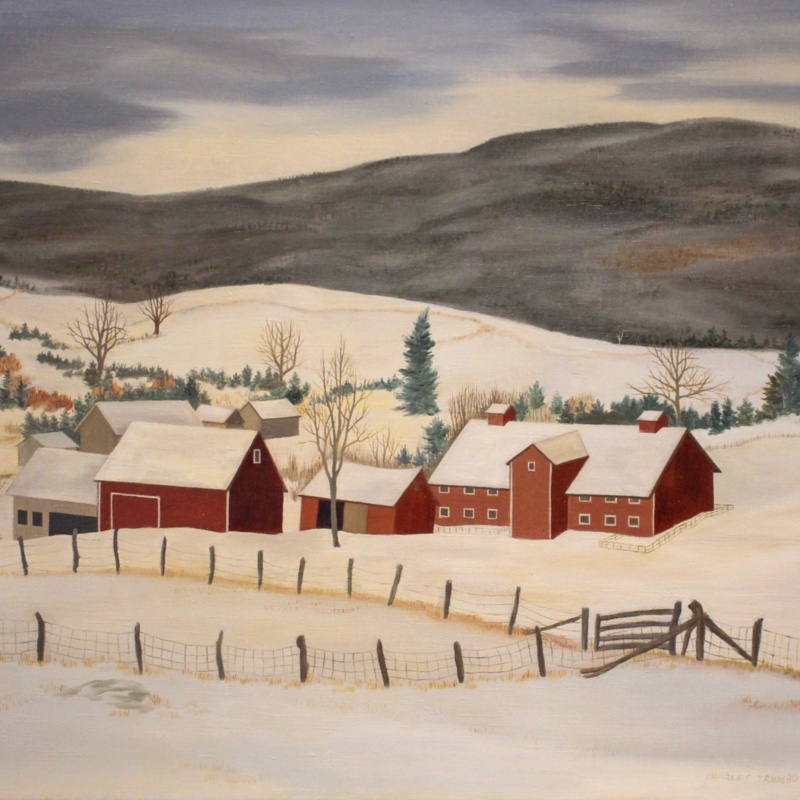
Snowy Landscape depicts farm buildings located in a mountain valley, their grays and reds deeply saturated to attract the viewer's eye. The structures are perhaps slightly simplified, some lacking windows or even doors, and none seems to be the…
Dangerous Crossing
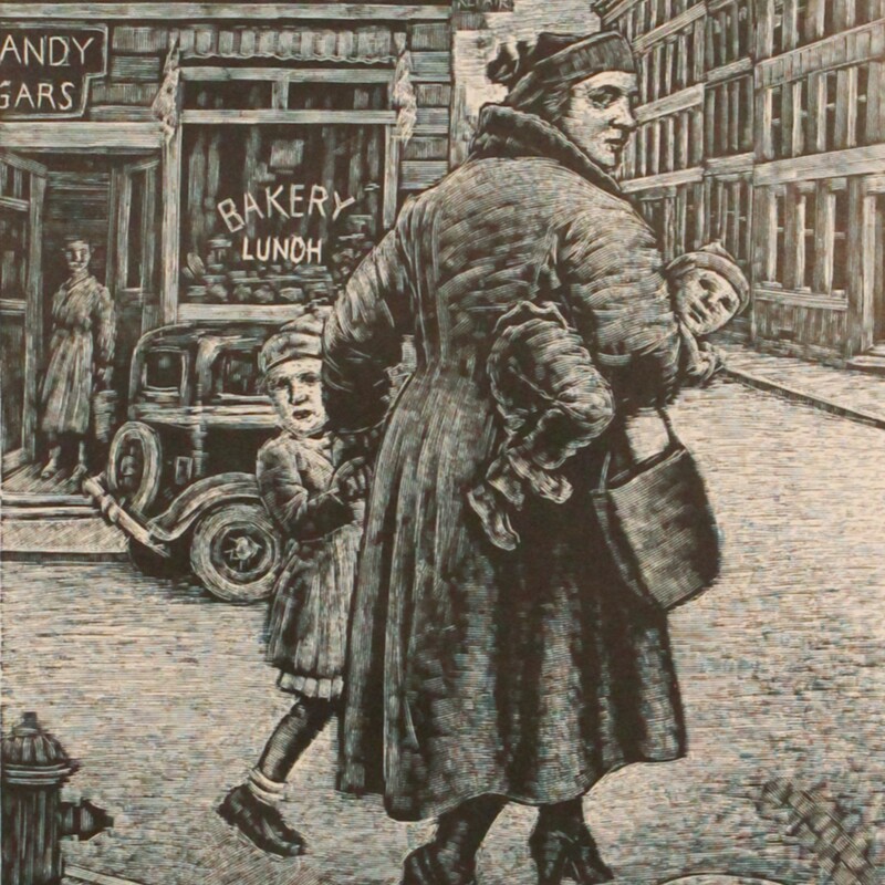
Abramovitz's woodcut print creates a heavy contrast thanks to it monochrome color scheme. Every etch in this engraving appears to be done with the same tool: fine, intricate lines create every form, figure, and detail in the piece. This approach to…
Gapstow Bridge, Central Park
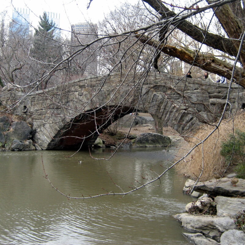
Situated at the northeast end of the pond in Central Park, the Gapstow Bridge was envsioned as part of Frederick Law Olmsted and Calvert Vaux's network of trails, tunnels, and bridges--both functional and aesthetically pleasing. This one was…
For a Carefree Vacation, Keep in Touch by Telephone

During the 1920s-30s, telephone service developed from a luxury facilitated by telephone operators, to a self-dialed consumer necessity. Or so the phone companies suggested. This series of three advertisements from 1940 envisions humorously…
News

A man and a woman are peering at a newspaper. The woman stands behind the seated man as she softly holds his shoulder; by comparison, he grips the newspaper tightly. The print is a high-contrast black-and-white charcoal portrait that uses value and…
Garden Scene

Two women are depicted holding one another, one nude and the other clothed. While the brushstrokes are liberated and cloud the painting, it is obvious there are another two figures in the background observing these women. This addition to the work…
Winter Day

A city street is rendered using a loosely sketched framework of lines and scribbles, overlaid with lithographic shadings and textures. Some of its details, like a cart in the foreground, remain insubstantial and undeveloped. Several human figures are…